You can fall in love with a South Texas ranch at first sight, but the value lives in the details you can’t see from a gate photo. In La Salle County, water, access, habitat, and clear paperwork make the difference between a great hunting place and a costly project. If you want a ranch that hunts well and holds value, you need a simple plan to verify the big levers before you write an offer. This guide gives you a practical, field-ready approach tailored to La Salle County so you can compare listings with confidence. Let’s dive in.
Know La Salle County basics
La Salle County sits in classic South Texas brush country with mostly flat to gently rolling terrain and elevations around 400 to 600 feet. Vegetation includes mesquite, huisache, guajillo, prickly pear, and native grasses, which create strong cover for deer when managed well. For a quick county snapshot, use the Handbook of Texas overview of La Salle County.
Average annual rainfall is generally in the low 20-inch range and varies year to year. That variability affects stock tank reliability and forage productivity, so plan for dry cycles. For context, see the Texas Almanac county profile.
Nearby, the Chaparral Wildlife Management Area provides a useful reference point for habitat condition and deer management outcomes on well-managed native rangeland.
Map soils with confidence
Soils drive road stability, sendero potential, and small food-plot feasibility. Use the county soil survey or SSURGO data to locate loams on uplands, heavier clays in drainages, and caliche. A historic county-level survey is available through the Soil Survey of La Salle County. Download the map units for each listing and compare before you visit.
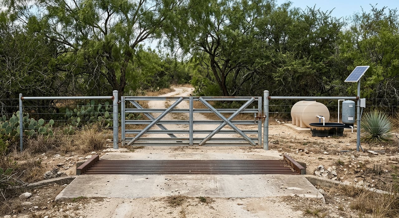
Put water first
In South Texas, dependable water supports both livestock and wildlife. Confirm quantity, quality, and legal compliance for every well and stock tank on the property.
Groundwater and permits
Much of La Salle County overlies the Carrizo-Wilcox and related coastal plain aquifers. Yields and water quality can vary by area. Read background on the Carrizo-Wilcox aquifer from TWDB, then identify which aquifer underlies the tract you are considering.
La Salle County falls within the Wintergarden Groundwater Conservation District. The district manages well registration, permits, and spacing. Ask the seller for well registration numbers and check permit history with the Wintergarden GCD.
Documents and tests to require
- Well log or driller’s report, State Well Number, and recent pump test results showing sustained gallons per minute.
- Lab water-quality analysis covering TDS, salinity, iron, bacteria, and hydrogen sulfide.
- Inventory of stock tanks with GPS points, watershed estimates, dam and spillway notes, and last maintenance date.
Tanks and surface water
Walk the largest tank and inspect the dam, spillway, shoreline, and signs of seepage or heavy siltation. In areas draining to the Nueces or Frio, confirm riparian ownership and any public-use limitations tied to navigable riverbeds. Your goal is a realistic view of water reliability during dry spells.
Wildlife, habitat, and programs
You should expect white-tailed deer, feral hogs, dove, and turkey across much of the county, with quail where grass and food mosaics allow. Habitat condition matters most. Focus on brush composition, mast sources, and the arrangement of cover and openings near likely stand locations.
TPWD programs to verify
Many South Texas ranches participate in Texas Parks and Wildlife programs like Managed Lands Deer Program (MLDP) or Deer Management Permits (DMP). Ask whether the ranch is enrolled, what tags or harvest logs exist, and how that may affect your plans. For program context, review TPWD materials from a prior MLDP-related work session.
High fence and disease diligence
If the property is high fenced or has a history of breeder releases or trap-and-transfer activity, ask for documentation of releases and any testing. TPWD has discussed updates to deer-breeder and disease management policies in recent meetings. See TPWD’s work session transcript on breeder rules and CWD context to understand why these questions matter.
Access and minerals
- Confirm recorded, deeded vehicle access. If access crosses another property, get the recorded easement and assess road condition in both dry and wet periods.
- Order a current survey or require updated corner evidence. Compare fences to deed lines.
- Review recorded easements for pipelines or utilities and any surface-use agreements tied to existing mineral leases. In areas with Eagle Ford activity, understand how surface operations could affect roads, water, and day-to-day use.
Improvements to inspect
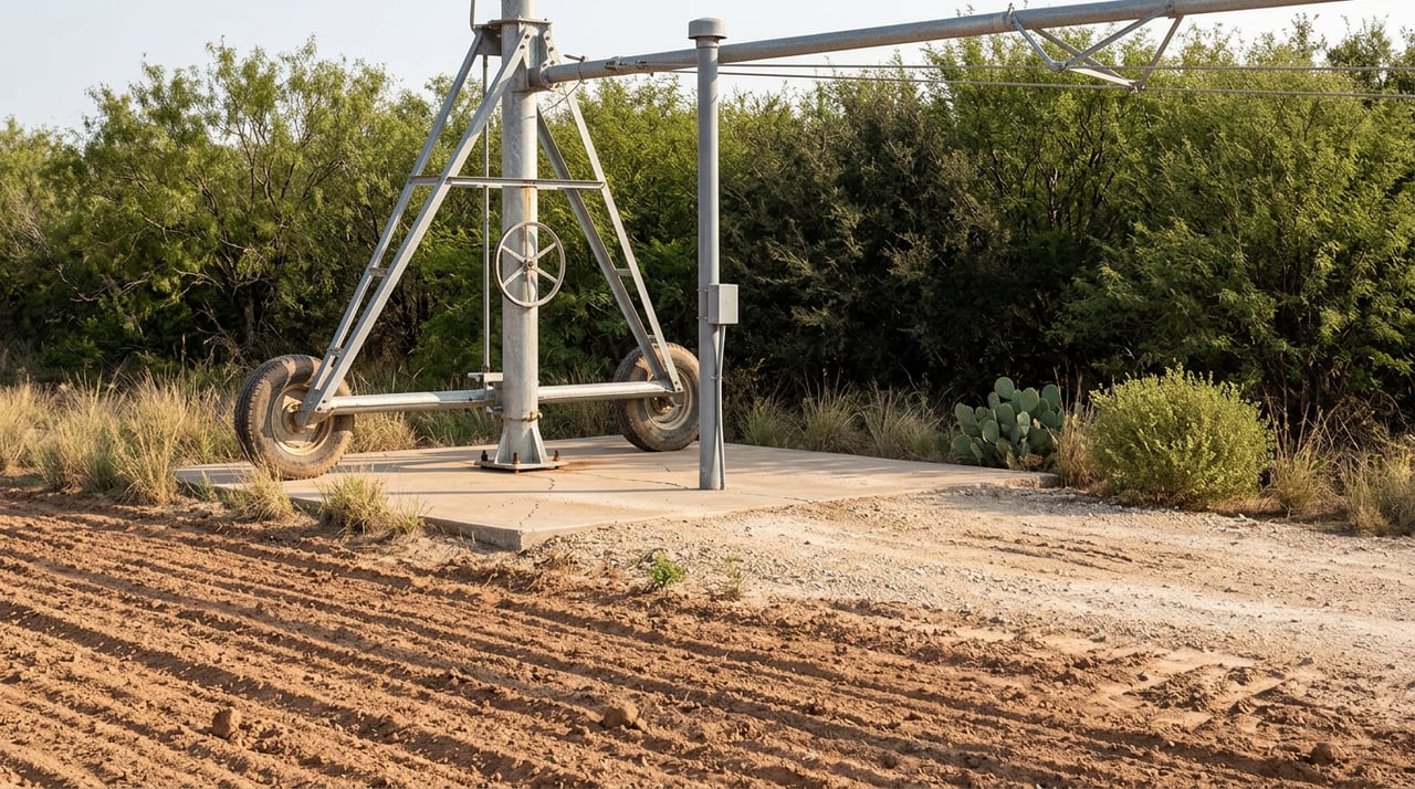
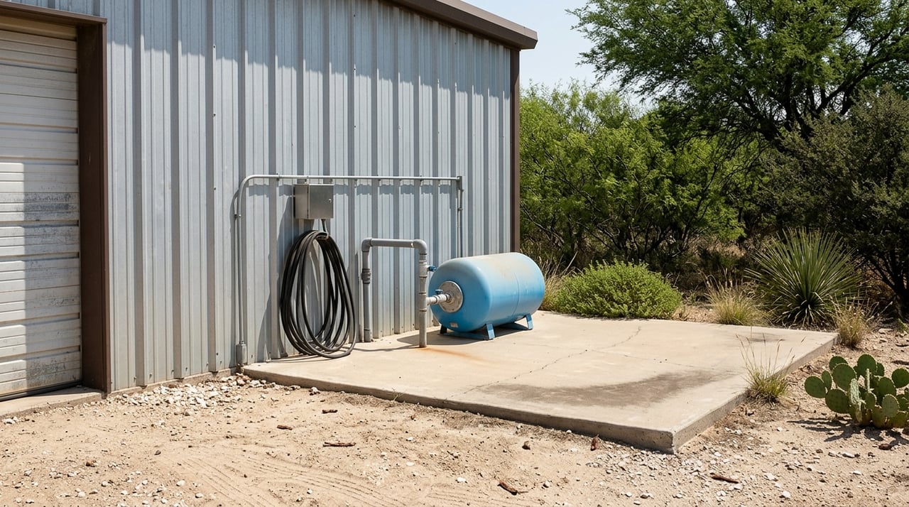
- Water infrastructure: well head, pump, power source, piping, cisterns, and service history.
- Fencing: perimeter and cross-fences, gate types, and any high-fence sections. Note miles of fence and condition.
- Working pens and traps: functionality and safety.
- Roads and crossings: erosion control, low-water crossings, bridges, and maintenance needs.
- Camp and utilities: septic, electric service, and internet options. County-level broadband adoption data from the Census QuickFacts can help set expectations for connectivity.
Taxes and ag valuation
Check current appraisal and whether the property carries an agricultural or wildlife valuation. These valuations do not always transfer automatically. Confirm local rules and any rollback risks with the La Salle County Appraisal District.
Field checklist for site visits
Use this sequence on your first on-site walk:
- Drive every main road. Note washouts, gate security, and travel time from the highway.
- Walk at least one boundary corner and a fence line. Verify markers against the survey.
- Inspect the main well. If possible, run the pump, note static and pumping levels, and take a sample for lab testing.
- Visit the largest stock tank. Check dam integrity, spillway, and shoreline cover.
- Evaluate cover and openings from a blind or vantage point. Look for senderos and bedding areas within 300 to 800 yards of stand locations.
- Check roads to feeders, blinds, and trap pens and confirm they are included in the sale.
- Photograph improvements and collect GPS points for wells, tanks, and key features.
Timelines and cost ranges
Treat these figures as planning guidance and get local bids:
- Water wells and pumps: Drilling and installation often price by depth and setup. Consumer guides place drilling in broad ranges by foot, which can put a 200 to 400 foot well in the thousands to tens of thousands including pump and wiring. See a practical overview from Angi on well drilling costs.
- Fencing: Basic barbed-wire livestock fencing is commonly quoted in dollars per linear foot, with wide variation by terrain and materials. High fence sections are substantially more expensive. For a planning snapshot, review fence installation cost ranges.
- Brush work and senderos: Forestry mulching and brush clearing often run in the low-to-mid thousands per acre depending on density and access. Prioritize corridors, food-plot sites, and strategic mosaics instead of clearing large blocks at once.
- Stock tanks: Modest dam repairs can be a few thousand dollars. Full reconstruction can be much higher and may need engineering.
Typical timelines:
- Immediate: boundary checks, pump tests, small repairs, gate locks.
- Short term, 1 to 6 months: fence and road repairs, waterline fixes, first food plots.
- Medium term, 6 to 24 months: well drilling if needed, larger brush units, tank work, and systematic habitat steps.
Red flags to avoid
- No well log and no recent pump test for the only well.
- Verbal access without a recorded easement.
- Heavy, unrecorded surface activity tied to oil and gas without surface-use agreements.
- Unclear history of breeder releases, trap-and-transfer, or missing disease-testing records on a high-fence ranch.
- Older earthen dams without an engineer’s inspection.
Due diligence sequence
- Request key documents up front: deed and legal description, survey, well records and pump tests, stock-tank map, fencing map, mineral-lease list, TPWD MLDP/DMP enrollment and harvest logs, and tax records.
- Order a title commitment and mineral-title search. Review recorded easements and pipeline rights-of-way.
- Schedule the site visit with a qualified wildlife or natural resource professional and a well contractor for on-site testing.
- Verify well registration and permits with the Wintergarden GCD. Check any reported restrictions.
- Get written bids for required improvements and include them in your offer strategy.
Ready to compare La Salle County ranches with a clear, land-first process? Start a conversation with Craig Wilson to walk through a property the right way and make a confident offer.
FAQs
What should I verify about a ranch well in La Salle County?
- Require the well log, State Well Number, and a 24 to 72 hour pump test with measured static and pumping levels, plus a lab water-quality report.
How do TPWD MLDP tags affect my purchase plans?
- Ask if the ranch is enrolled in MLDP or DMP, review harvest logs, and confirm whether permit status and tags can transfer under TPWD rules before setting harvest expectations.
Do high fences always improve deer quality on South Texas ranches?
- High fences change wildlife movement and management costs. Focus on documented management history, releases, and disease testing rather than assumptions about outcomes.
How do I confirm an agricultural or wildlife valuation will continue?
- Check current status and requirements with the La Salle County Appraisal District and plan for any application steps or rollback risks after closing.
Are stock tanks reliable given local rainfall patterns?
- Average rainfall is in the low 20-inch range with yearly swings, so evaluate each tank’s watershed size, dam condition, and lining or seepage to gauge reliability.
What if the minerals are severed from the surface?
- Order a mineral-title report, review current leases and surface-use provisions, and understand how operations could affect roads, water, and day-to-day use before you buy.